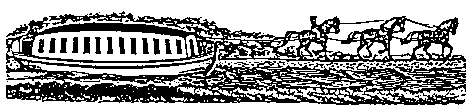
Ohio's 1000-mile network of navigable canals, constructed between 1825 and 1847, provided a system of economical transportation where none had previously existed. The young state with its isolated frontier economy was transformed almost overnight. The canals opened many markets for its agriculture and industrial products, and attracted thousands of immigrants to the state. Today only a few of the deep excavations, the high earthen embankments and the massive structures of timber and cut stone are left to remind us of our debt to those who built Ohio's first transportation system.Ohio & Erie Canal Sites
Remains of the Ohio and Erie Canal, which ran from Cleveland to Portsmouth, may be seen at the following locations:Cleveland. One of the longest stretches of water-filled canal lies S along Canal Road from East 49th Street. Towpath trail from Rockside Road to Bath Road is within the Cuyahoga Valley National Recreational Area. Locks, aqueducts, mill and Canal Visitor Center are highlights.
Peninsula. Deep Lock Quarry Metro Park, 1 mile S of SR 303 along Riverview Road. Lock 28, Deep Lock, had the highest lift of the 42 locks between Cleveland and Akron. Stone for the lock and for grindstones was quarried from the adjacent area. Hiking.
Akron. Cascade locks N of downtown. Lock 2 Park at Buchtel Avenue one block W of Main Street. Outdoor exhibits. Eight miles of water-filled canal S from Market Street to the Portage Lakes (early canal reservoirs) and Barberton.
Canal Fulton. A mule-drawn canalboat replica, St. Helena III, operates from SR 93, carrying passengers to Lock 4 and back (May-October). Public park, canal museum, restored canalboat dry dock.
Bolivar. Three-mile hiking trail S on canal towpath between Fort Laurens and Zoar Village, both Ohio Historical Society sites. Four canal locks can be seen along the trail.
Coshocton. Roscoe Village, restored canal town open all year with museums, exhibits, restaurants and shops. Towpath walk and footbridge on site of Walhonding Aqueduct lead from Roscoe through Lake Park. The lake was a former canal basin. Recreation area open to the public. The Monticello II, horse-drawn canalboat replica, operates May-October. Triple Lock of the Walhonding Canal, just NW of Roscoe, is an outstanding artifact. Picnicking.
Newark. Black Hand Gorge State Nature Preserve, 10 miles E at Toboso. Guard lock, slack-water dam site, cliff-face towpath, and interurban tunnel are highlights. Hiking and bike trails. Lock 1, 3 miles S of Newark on SR 79 in Heath. Marked by monuments commemorating the site of groundbreaking ceremonies on July 4, 1825.
Hebron. Buckeye Lake, 2 miles S of Hebron. Originally a canal reservoir, now a popular recreation area. Four miles of embankment contain the lake. Stretches of water-filled canal lead N and W. Picnicking and boating at the state park. Deep Cut, excavated for the summit level of the canal, is visable S of SR 204 along Deep Cut Road in Millersport.
Lockville. Stone masonery locks 11, 12 and 13 and a relocated covered bridge in Lockville Park along Pickerington Road. Picnicking.
Groveport. Lock 22 and a portion of canal bed in Blacklick Park at east end of Blacklick Street. Hiking and picnicking.
Lockbourne. Locks 26 and 27 along Canal Road E of village. Lock 29 along Canal Street W of railroads. Lock 30 in village park N from Commerce Street at Denny Street. Guard lock and lift lock of Columbus Feeder along Rowe Road at Big Walnut Creek.
Circleville. Stone abutments of Scioto River aqueduct 500 feet S of SR 22. A 3-mile water-filled stretch of canal, 1 mile S of US 22, along Canal Road W of Circleville. Fishing.
Chillicothe. Restored canal-era storefronts along Water Street (formerly the canal bed) between Walnut and Mulberry Streets. Canal Warehouses at NE corner of Mulberry and Main Streets. Canal bed and locks are visible along Three Locks Road SE from US 23, 3 miles S of Chillicothe. No access.
Waverly. Lock 44 remnant along US 23. Canal bed visible along W side of SR 104 through Pike County S from Lake White. No Access.
Portsmouth. Riverside Park, off SR 73, S of US 52, W of Portsmouth. Outlet Lock, which lowered canalboats from the canal into the Ohio River, 1 mile W of boat ramp along abandoned Old River Road.
Miami & Erie Canal Sites
Remains of the Miami & Erie Canal, which ran from Toledo to Cincinnati, may be seen at the following locations:Maumee. Side Cut Metropark, W of Maumee off US 24. Three of the original six locks of the Maumee Side Cut, which lowered canalboats into the Maumee River. Picnicking and hiking.
Waterville. Farnsworth, Bend View and Providence Metroparks are interconnected by an 8-mile hiking trail along the towpath leading to Providence Dam. Ludwig Mill, a working, water-powered facility near the dam is open on Sunday, May-October. Lock 9 lies adjacent to mill.
Grand Rapids. Mary Jane Thurston State Park on SR 65 provides access to Grand Rapids Dam and the adjacent guard lock for the Gilead Side Cut to Grand Rapids. The dam created a slack-water pool in the river for canalboats. Towpath hiking along the side cut. Canal boat ride through a working lock.
Independence. Independence Dam State Park on SR 424. A well preserved canal lock. Recreational facilities.
Delphos. The Miami and Erie Trail, a 40-mile long section of the old towpath, extends southward from Delphos to Lake Loramie State Park. Many lock sites, Deep Cut, Forty Acre Pond and several canal towns lie along this attractive hiking trail.
Spencerville. Deep Cut, 2 miles S of SR 66 is a 6,600-foot long excavation to carry the canal through a glacial moraine. A National Historic Landmark. Picnicking and hiking.
St. Marys. Four-mile hiking trail along water-filled canal from Geiger Park N through St. Marys and the St. Marys River valley to Forty Acre Pond, a widewater of the canal. Raceway to city power plant.
Celina. Grand Lake St. Marys. Constructed as a canal reservoir. It now provides fishing and boating with other recreational facilities in the adjacent state park.
New Bremen. Lock 1, in center of town at N end of the Loramie Summit. This 23-mile stretch was the highest level of the canal.
Fort Loramie. Lake Loramie on SR 362. Former canal reservoir, now a state park with fishing, camping, swimming and picnicking.
Lakeview. Indian Lake, formerly the Lewistown Reservoir. Remote from the canal, in Logan County, it supplied water downriver to the Sidney Feeder. The dam embankment extends westward 4 miles from the spillway. Now a state park with many recreational facilities.
Port Jefferson. Canal Feeder Reserve, a park 1 mile E on SR 47. At the head of the Sidney Feeder. Remnants of old feeder dam nearby in the Miami River. The dam supplied water through the feeder canal to the Loramie Summit level at Lockington.
Lockington. Lockington Locks State Memorial. Flight of five locks that lowered canalboats 67 feet in a half-mile from the Loramie Summit to Loramie Creek and on to the Miami River valley. Aqueduct remnants visible in Loramie Creek.
Piqua. Piqua Historical Area, 2 miles NW on SR 66. The Genl Harrison, mule-drawn canalboat replica carries passengers on a restored section of the canal (May-October). Lock 10, 3 miles S along CR 25A at Farrington. This stone masonry remnant has interesting and varied finish work. Twin-arch stone culvert under canal bed, 4 miles S along CR 25A. Visible from highway. No access.
Tipp City. Lock 15, of stone masonry, just N of Main Street. Picturesque old grist mill structure adjacent.
Dayton. Carillon Park, 2 miles S along Patterson Blvd. Reconstructed canal lock, canal superintendent's office, and other early transportation exhibits. Picnicking.
Middletown. Canal Museum, Tytus Avenue and Verity Parkway, in replica lock-tender's house (Sunday, 2-4 PM, May-October). Excello Lock Park, 3 miles S on Main Street, S of SR 73, at Excello. First lock completed on the canal, later rebuilt of concrete. Historical marker.
Hamilton. Miami & Erie/Rentschler Forest Preserve, 4 miles NE off SR 4. Recreation areas and hiking trails along the towpath.
Cincinnati. Bicentennial Park, East 2nd Street at Eggleston Avenue. Site of flight of locks to Ohio River. Park contains representation of a canal lock and a profile diagram of the Miami & Erie Canal.
For information on other Ohio canal sites check out the Canal Society Of Ohio